2015·Pantex Plant, Amarillo (Carson County), Texas
United States.Pantex · unidentified object over the nuclear plant (2015)
On 1 September 2015, the Ground Surveillance Radar (GSR) at the Pantex Plant, the primary U.S. nuclear-weapons assembly facility (Amarillo, Texas), detected an unidentified object to the west, flying north at 10–15 mph. The Protective Force activated the drone response plan, secured the gates and pursued it by vehicle.
Read the rest of the summary
Through binoculars they saw no propulsion and heard no sound; the object (a 'diamond' of about 4 ft, which sped up and changed course when followed) was tracked by a Bearcat's CROWS camera and filmed from the GSR tower. The video went to Sandia and the evidence to the FBI. Report declassified in 2026.
Tier S · SolidWhat do they mean? →
Strong evidence: a contemporary instrumental record (radar, sensor, film or photo of known provenance) that corroborates several independent witnesses.
What it was
66%natural or human cause
Most likely explanation: adversary technology
See the split across the six explanations
Natural or human cause
No known cause
Read the full reasoning
The absence of a published analysis is not evidence against an ordinary cause: in its 2024 report AARO stated that 'all 174 cases have been finalized as resolved to prosaic objects including balloons, birds, UAS, satellites, and aircraft'; the same report adds that 'many other cases remain unresolved', so the figure is the rate among resolved cases, not among all cases.Primary documents
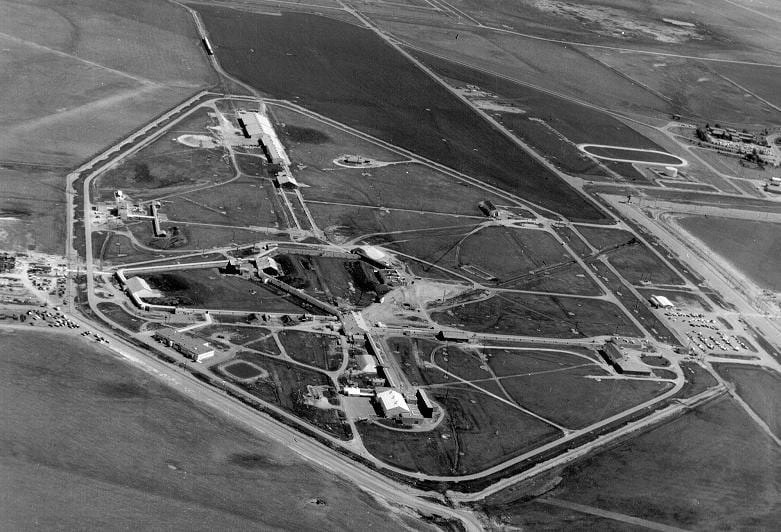
Context · the Pantex Plant (Amarillo, Texas), over which drones were reported
Pantex plant aeriel unknown data.jpg · Wikimedia Commons · Public domain · open original
DOE-UAP-D001 — Pantex Unidentified Object Incident Report (UCNI)
The Pantex Unidentified Object Incident Report (DOE-UAP-D001) is a Department of Energy report, marked UCNI, about the only U.S. nuclear-weapons assembly and disassembly plant, with an image captured from a ground surveillance radar tower and enhanced images of the object by Sandia National Labs. It was declassified in the second PURSUE release (22 May 2026) together with 1970s correspondence of Los Alamos physicist James L. Tuck and a 1986 invitation to a talk on UFOs at Los Alamos. It documents institutional attention to the phenomenon inside the nuclear complex; it does not prove the object was anomalous.
Department of Energy / Pantex · CNS (PURSUE Release 02) · Public domain · US Government work · open original
The night in question
On 1 September 2015, at around 07:08–07:10, the Ground Surveillance Radar (GSR) system at the Pantex Plant (the primary U.S. nuclear-weapons assembly and disassembly facility, in Amarillo, Texas) detected an unidentified object flying in a 'non-threatening' manner west of the facilities, on a northerly trajectory at about 10–15 mph (16–24 km/h). The object appeared roughly 1.75 miles southwest of the Zone 12 South building, near Highway 60. The Protective Force activated the unmanned aerial systems (UAS) response plan approved by the NNSA production office: all pedestrian and vehicle gates in the security areas were immediately secured and patrols repositioned to protect assets.
A lieutenant and a security police officer (SPO) pursued the object by vehicle along Pantex Drive, trying to position themselves directly beneath it to observe it. They could not catch up; when they stopped and got out, they noted that the object made no sound and that, even with binoculars, they could not identify any propulsion system. They watched it for 1–2 minutes before it continued north offsite; they followed it several miles until they lost it for lack of roads, near County Road G and FM 1342. They noted the object 'seemed to increase speed and change direction while being followed,' its final heading ENE. The Carson County Sheriff's office was notified and a deputy responded, but never saw the object.
The descriptions were partly inconsistent: a 'diamond' shape, more rounded and thinner at the top, about 4 feet tall by 2 feet wide at the base; the color varied between black, silver, red and blue depending on the witness. Another SPO team, in an armored Bearcat vehicle equipped with a Common Remotely Operated Weapon System (CROWS), tracked the object with the CROWS camera for 3–5 minutes at 75–100 meters, estimating it at 100–200 feet altitude. Video was obtained from the nearest GSR tower and sent to Sandia National Laboratories for enhancement and study, though the distance left little detail. All evidence, statements and video, was turned over to an FBI agent. The report, classified as Unclassified Controlled Nuclear Information (UCNI), was declassified in 2026 within AARO's UAP Records (code DOEUAPD005). In September 2026 the NNSA released, in response to FOIA request 23-00131-R, another copy of the same report, dated 2 September 2015, with almost all of the text redacted as controlled nuclear information: what can be read confirms that Protective Force personnel followed the object by vehicle 'for several miles north of the plant until it was no longer visible', that a comprehensive review of the incident was immediately initiated, and that the object was described as a 'diamond' type shape 'more round at the top'. The cover letter of 9 September places the incident on 2 September, one day after the date given in the report AARO declassified.
Why it matters
It is a multi-sensor incident documented by the institution itself. A security radar (GSR) detected it, several trained officers confirmed it separately at close range, one with binoculars, a CROWS camera on an armored vehicle tracked it, it was filmed from a tower and the video sent to Sandia National Laboratories; the evidence ended up with the FBI and the paperwork was filed as Controlled Nuclear Information at the facility that assembles the U.S. warhead stockpile. It happened at the installation that arms and disarms the arsenal.
At the same time, a reading requires noting that the site itself treated it as a drone incursion: it activated its UAS response plan, and at no point did the object threaten sensitive assets. In 2015, amid a wave of drone incursions over U.S. military and nuclear installations, one hypothesis is an unmanned system, perhaps adversary surveillance. What resists that reading are the details reported by the observers: no sound and no visible propulsion system, a 'diamond' shape barely over a meter tall, color discrepancies, and the datum that the object reportedly sped up and changed direction when pursued. None is conclusive on its own (perception at a distance with a single visual sensor is notoriously deceptive) but together they stop it from being closed as a trivial drone.
What's left on paper
Documented evidence
- Official 'Pantex Unidentified Object Incident Report' (DOE/NNSA, 2 Sep 2015), classified UCNI; event of 1 Sep 2015 ~07:08–07:10
- Ground Surveillance Radar (GSR) detection west of the plant; gates secured under the NNSA UAS response plan
- Vehicle pursuit by a lieutenant and an SPO: no sound, no propulsion system visible through binoculars; watched 1–2 minutes
- CROWS-camera tracking from a Bearcat for 3–5 minutes at 75–100 m; estimated altitude 100–200 ft
- 'Diamond' shape (~4 ft tall), color discrepancies (black / silver / red / blue); sped up and changed course when followed
Show 2 more items
- GSR-tower video sent to Sandia National Laboratories for enhancement; evidence turned over to an FBI agent
- Carson County Sheriff notified; the deputy never saw the object
Sources
- DOE/NNSA — «Pantex Unidentified Object Incident Report» (2 sep 2015), Unclassified Controlled Nuclear Information — Primary document. Declassified in 2026 in the AARO UAP Records, release 04, code DOEUAPD005.
- AARO (All-domain Anomaly Resolution Office) — UAP Records / Cases Library
- The Black Vault — archivo del incidente de Pantex (2015) — Secondary coverage of an earlier version of the report obtained via FOIA; corroborates date, place and description.
- NNSA — FOIA 23-00131-R, doc. 5: «Pantex Unidentified Object Incident Rpt, Sep 2, 2015» (versión tachada, publicada en sep 2026) — Primary copy of the report with most of the text redacted; confirms the vehicle pursuit and the 'diamond' shape.
- AARO — Fiscal Year 2024 Consolidated Annual Report on UAP (Nov 14, 2024)
Related cases